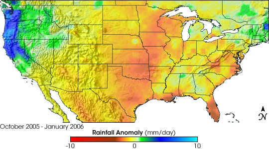
Southern U.S. Extreme Drought This image shows where daily rainfall was above and below average in the United States between October 2005 and January 2006 compared to the eight-year average for that time frame. Places where rainfall was above average are in blue and green, while places rainfall was below average are in orange and red. The data are from the Tropical-Rainfall-Measuring-Mission-based, near-real-time, Multi-satellite Precipitation Analysis at the NASA Goddard Space Flight Center.
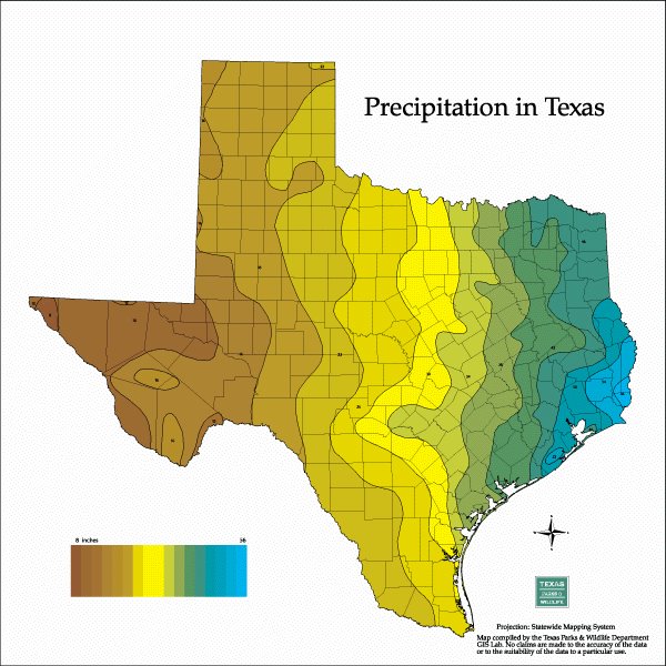
Texas A&M System provides the following chart


No comments:
Post a Comment